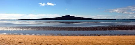
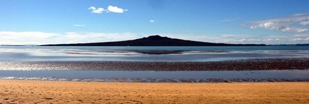
There is something special, almost magical about the light in New Zealand; an effect amplified when you are immersed in building a huge sand-castle and you glance up at the view. I was with a friend and her kids on the wide sands exposed at low-tide on Cheltenham Beach in Devonport, just across the bay from Auckland. Our sand-castle had walls, turrets and towers, but its centre-piece was a simple conical hill, with a make-believe dragon hiding inside the mountain. The warm summer sun had us all smothered in the obligatory high-UV factor creams, which mixed immediately with sand to make the familiar grinding paste that reminds you of sun-burn long before you ever get burned. I looked up from our construction site, a few hundred meters out, a couple of heads bobbed rhythmically in perfect synchronization – open-water swimmers doing laps on this kilometre-long beach. With the sun starting its evening slide behind us, the lengthening rays shone a spotlight on Rangitoto – the model and inspiration for our Dragon Castle.
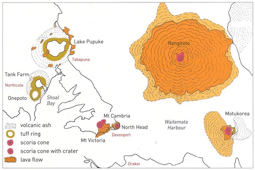
Through the clear air you could almost reach out and touch the island, it felt close, immediate. Indeed, it is close but not just in distance. Swapping meters for years, it is really very, very close and very immediate. Six hundred years ago, the bat of a dragon’s eye in geological time, Rangitoto rose from the waters in fiery splendour.
One night a 'tupua’ couple, started to argue. This couple were children of the Fire Gods. In their argument they cursed the fire deity Mahuika. Mahuika heard them and went to Mataoho, the deity of earthquakes and eruptions. He sent an eruption to destroy the couple’s mainland home on behalf of Mahuika.
As a result, their home was swallowed up by the earth to become Lake Pupuke on Auckland’s North Shore; this led to Rangitoto rising out of the sea. When mist surrounds Rangitoto, it is said that it represents the tears of the couple as they weep over their lost home. (source)
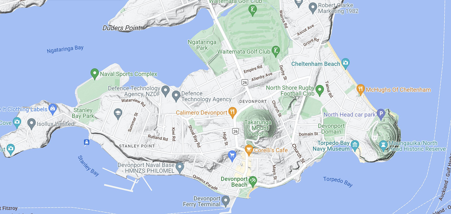
Earlier that week we had walked the dog on North Head (Maungauika), the southernmost point of the Devonport peninsula – which looks not too dissimilar to Tele-Tubbie land, with undulating hillocks carpeted with lush green vegetation, or indeed Hobbiton, (which was actually filmed several hundred kilometres south in King Country…). North Head is a labyrinth of tunnels and gun emplacements dating from the 2nd world-war. This headland would have been the primary defence point for the entrance to Auckland harbour: strategically located and, well, hilly. Maungauika and nearby Takarunga (Mount Victoria) are verdant dog-walking hills which also happen to be small volcanic ejection cones – related to the wider volcanism of the area.
If I were you, I wouldn’t build it here…
Rangitoto really is the poster child of what a volcano should look like; a perfect cone, its sloping sides following curves mathematically constructed by the angle of resistance to rock slides. It was jet-black and growing blacker as it slid into silhouette – the dark volcanic rock poking up out of the sea like the tip of an iceberg, reminding anyone who cares to remember, that most of the action is down below, invisible to the viewer.
The kids know that this is volcano – it is actually pretty hard to miss - being 5km wide and 260m high, and kids love volcanoes almost as much as dinosaurs. In fact, it is a wonder that the world isn’t populated by geologists given the early fascination that the earth holds for young minds. Sadly, or perhaps not, childhood joy and fascination with dinosaurs, volcanoes and magic-rocks found in creeks becomes diluted by other learnings, and people become bankers and town-planners and sailors and teachers, or academics or, well, just people. We become inured to the awe-inspiring as we seek to make our way in the world. Which is a pity, because if the early sailors and settlers who came here and found the picture-perfect Hauraki Gulf had paid a little bit more attention to the geology and to the fact that there were few indigenous Maori settlements here – they might have admired the harbour and then quickly sailed on….
Because they didn’t, New Zealand’s biggest city now sits on top of a “dormant” Shield type volcano – quite how comforting the term “dormant” is when applied to a volcano that erupted as recently as 600 years ago is very much a question of perspective. If you are sipping a green power-juice in Ponsonby after your morning yoga class, it may be that your youth feels like a long time ago and 600 years is an eternity. If however, you have been involved in recent studies of ash sediments from the nearby Lake Pupuke and separately from a rock-core that was drilled out of Rangitoto in February 2014, you may think that the 600 year old eruption that created Rangitoto was actually just the most recent expression of a punctuated continuum of volcanic activity in the immediate vicinity going back 6,000 years. Certain texts refer to the formation of Rangitoto as the ‘final eruption’ in this process – which begs the question of when is a volcano considered active, dormant or extinct. Who says this is “final”?
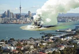
Whilst Auckland is the largest city by population in NZ, we can all breathe a sigh of relief as the seat of government is in Wellington, so even if catastrophe befalls Auckland, what’s left of NZ will still be governed.
That is, unless we should be more worried about earthquakes than about dormant volcanos… because Wellington sits smack on an absolute beauty of a fault. Whilst talking about volcanos, don’t get me started on Naples, Italy…
But those stories will have to wait for another day.



yep, scary stuff indeed. Although I wrote this piece (and a bunch of other stuff) in about 2017 - before that sad event...
Nice. Have you watched the documentary The Volcano on Netflix?